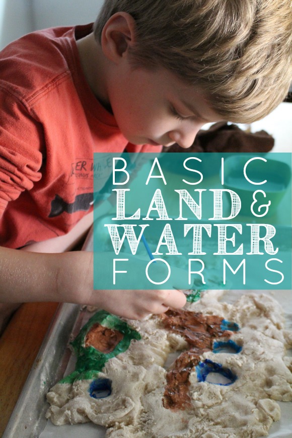
 Last month in our Geography lessons we had a lot of fun exploring basic land and water forms. The basic land and water forms include: bay, cape, island, lake, strait, isthmus, system of lakes, archipelago, gulf, and peninsula.
Land & Water Form Tray
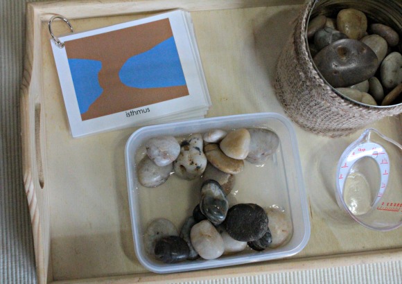
You can buy sets of the form trays, but since I like to try to save on both space and money I opted for a DIY version. We used just one tray and the kids had to shape the land form with rocks and then pour water in using a small measuring cup.
We kept the land & water form book on hand, so they could choose a land form to build and have an example.
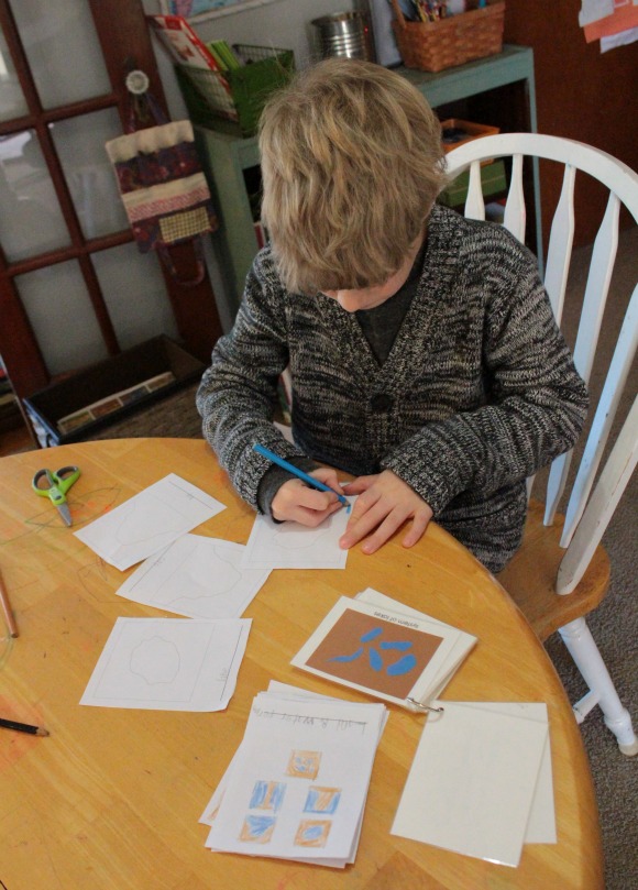
Land & Water Form 3-Part Cards
We used the standard land and water form cards and then later introduced the land and water form cards with pictures. For our basic land and water form cards we used Montessori Print Shop’s Land and Water Form Cards (blue/brown) and for the photo cards we used The Helpful Garden’s free download Land & Water Forms Photo Cards. I prefer her form cards and wish I had used those.
If you’d rather not do all the printing and cutting Alison’s Montessori has basic land and water form cards for 3 to 6 and 6 to 9 (with definitions).
Land & Water Form Book
As the child moves into the elementary years and the second plane of development, definitions are added to 3-part cards. There’s a plethora of 3-part cards out there, but very few with definitions. We ended up using a booklet of land forms to aid in this. For the form book, we used Montessori Print Shop’s Land & Water Form Book.
We also used The Helpful Garden’s Land & Water Forms blackline master to make our own land and water form books. With this the child has to color the form in its correct color (blue = water, brown = land) and write the name of each. There’s also a printable option for the child to trace.
Identifying Land & Water Forms on a Map
We talked a lot about where certain land and water forms are located and what’s the difference between similar land forms. Like, what’s the difference between a bay and a gulf? If you look at the Gulf of Mexico and the Hudson Bay on a map, they appear quite similar (at least to a 7-year-old).
Or how about a cape and a peninsula? How many islands do there have to be to be considered an archipelago?
We spent a lot of time pouring over our map and…asking Google. Do you know more than one strait? Now I do.
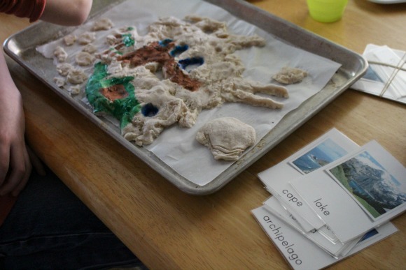
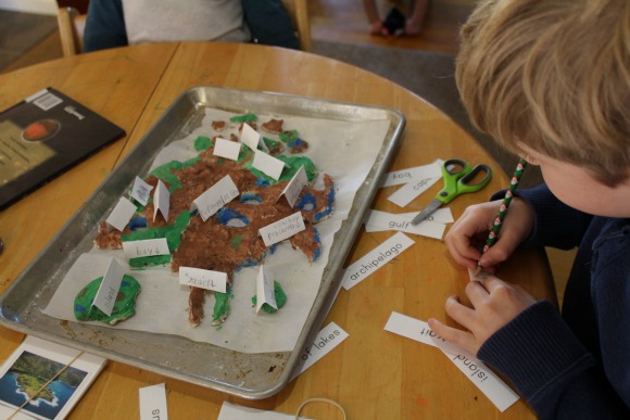
Making Your Own Salt Dough Land & Water Forms
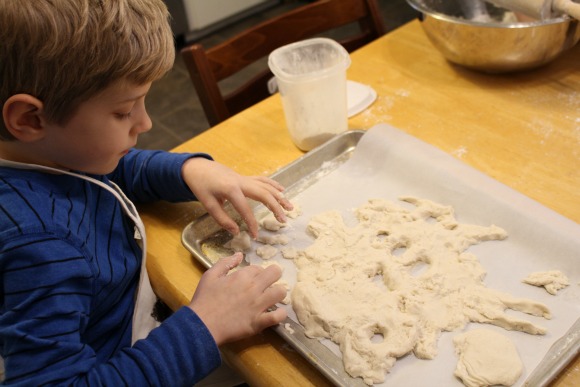
Probably the most fun was had when Joey spent a few days making his own land form island. He made the salt dough and shaped each formation. After the island was baked and cooled, he painted his island and even gave each form a proper name.


1 comment… add one
Fabulous post! I will be pinning and sharing for sure. Thanks for stopping by the It’s Elementary! link up 🙂